


In a traditional cemetery, a headstone does two jobs at once. It tells a story, and it tells you where to stand. You can arrive years later with a child who never met the person, trace a name with your fingers, and know you are exactly where you meant to be. In many green and conservation cemeteries, though, that familiar “stand right here” signal is intentionally minimized. The landscape matters. The habitat matters. The visual quiet matters. And for families, that can bring up a surprisingly practical fear in the middle of a meaningful choice: what if we can’t find them again?
This is where the idea of a GPS grave marker becomes less “techy” and more tender. In places where upright monuments are discouraged or not used, a set of coordinates or a digital map can function as the marker. It does not replace remembrance, but it protects it. It ensures that a future visit is possible, even if the field looks different, the seasons change the land, or the person who knows “exactly where it is” is no longer the one driving.
Why Some Cemeteries Don’t Use Headstones
Green burial grounds vary widely, but many share the same intention: to preserve a natural landscape and reduce long-term environmental impact. That can mean no concrete vaults, fewer synthetic materials, and limits on what permanently alters the terrain. The Green Burial Council explains that, depending on the cemetery, grave sites may be marked with GPS units, mapping, or native stone markers rather than conventional headstones. In other words, the “marker” might be a coordinate, a discreet ground-level stone, or a map maintained by the cemetery.
If you are choosing a natural burial or conservation cemetery, it helps to treat “how we will locate the grave later” as a standard part of funeral planning, not an afterthought. You are not being difficult by asking; you are doing future-you (and future family members) a favor. A thoughtful cemetery expects this question, because it is one of the most common anxieties families have when they first hear that headstones may be limited.
How GPS Grave Location Actually Works (and What Accuracy to Expect)
A digital grave location usually starts with a latitude and longitude—numbers that can be entered into a phone, a car navigation system, or a handheld GPS unit. Many cemeteries store this information in their internal mapping system and can provide it to families on request, sometimes alongside a section/row/plot reference or a printed map. Some conservation cemeteries also tie records to broader land management maps, where grave placement is one layer among trails, protected habitats, and restoration areas.
Accuracy is the part families worry about most, and it is worth being honest about what GPS can and cannot do. According to GPS.gov, GPS-enabled smartphones are typically accurate to within about 4.9 meters (16 feet) radius under open sky, and accuracy can worsen near trees, buildings, and other signal obstructions. In a natural burial ground—where tree cover is common—this matters. “Within 16 feet” can still feel vague if you are standing in tall grass with no visual cues.
The good news is that cemeteries that rely on coordinates know this, and many use practices that make “good enough” accuracy feel much more exact in real life: recording the grave corners (not just a single point), using a reference stake or discreet ground marker, tying the location to a mapped grid, and providing written directions from fixed landmarks (a gate, a path junction, a tree line, a boulder). Think of GPS as your way to get into the right neighborhood, and cemetery mapping as the way to find the right doorstep.
If You Need to Find a Grave Without a Headstone
If you are searching for a loved one’s resting place in a cemetery that uses minimal markers, the most reliable approach is almost always to start with the cemetery office or caretaker rather than guessing in the field. “Can you help me find a grave without headstone?” is a normal request in green burial settings. Ask for the exact format they store (decimal degrees vs degrees/minutes/seconds), whether they have a cemetery map you can email to yourself, and whether there are on-site reference points they recommend using.
If you are arriving without guidance—because records are old, the cemetery has changed hands, or you simply do not have the paperwork—your best next step is to gather every identifier you can: full legal name, dates, any plot purchase documents, the funeral home name, and the approximate burial date. If you are the person in the family who tends to keep documents, it is worth placing these items into a single “grave location” folder as part of broader funeral planning and end-of-life organization. Funeral.com’s End-of-Life Planning Checklist is a practical place to anchor that habit, because it encourages consolidating the information future family members will need—not only for finances and accounts, but for the details that make visits possible.
Natural Burial GPS Coordinates: What Cemeteries Typically Provide
Most cemeteries that use natural burial GPS coordinates can provide at least one of the following: a single coordinate point, a coordinate plus a plot reference, or a mapped location within a digital grid. The differences matter. A single point (especially if it is the center of a grave) is helpful, but recording corners is more accurate for future caretaking and for families who want to place flowers or stand at the same place each time. Some cemeteries also keep a “family plot” polygon—essentially a mapped outline—rather than only a point.
If the cemetery uses GPS as the primary marker system, ask two questions that can save you frustration later. First: what coordinate system and datum are you using (most consumer tools default to WGS84, but confirmation matters)? Second: are these coordinates intended for a phone, a handheld GPS device, or a professional survey system? Those answers shape how you should store and use the information. When in doubt, ask the cemetery to provide both decimal degrees and a written description from a landmark, because the combination is far more resilient than either one alone.
What to Record (So This Never Becomes a Future Problem)
When families hear “GPS,” they often think the only thing worth saving is the latitude and longitude. In practice, the safest approach is to record grave coordinates and also record enough context that a future visitor can succeed even if technology changes, apps disappear, or a phone gets no service on-site.
- Exact GPS coordinates as provided by the cemetery (copy/paste and also write them out).
- Coordinate format (decimal degrees vs degrees/minutes/seconds) and the datum if the cemetery provides it.
- Cemetery name, address, main phone number, and email (or caretaker contact), plus office hours if they are limited.
- Plot reference (section/row/lot/grave number) even if the cemetery “doesn’t really use” those terms.
- A written walking route from a fixed point (gate, trailhead, parking area, office) with approximate distance and turns.
- Landmark notes (for example: “20 feet north of the large oak,” “near the third bench on the left trail”).
- Photos taken standing at the grave facing each direction, plus a wider photo that includes a stable landmark.
- Date of burial and the name of the funeral home or burial ground manager who handled the placement.
- A shared storage location (a family folder, a printed copy with legal documents, and a copy with a trusted person).
That may look like overkill today, but this is exactly how families prevent the painful moment of returning years later and realizing nobody knows where to walk. If you are already organizing next steps—paperwork, service details, travel plans—this can be one of the most quietly loving parts of funeral planning: leaving behind clear information that makes remembrance easier, not harder.
Cemetery Mapping GPS and “Grave Map App” Tools
Some families ask whether they can rely on a grave map app the way they rely on a navigation app for restaurants. The honest answer is “sometimes,” but with caution. Some burial grounds have their own digital maps, QR-based systems, or interactive plot finders. Others prefer to provide coordinates privately rather than publish them widely. And in conservation cemeteries, connectivity can be unreliable precisely because the land is protected and less developed.
If the cemetery offers a map, the best approach is to save it in multiple formats. Email yourself a PDF. Store a screenshot on your phone so it is available offline. Print a copy and keep it with other planning papers. If the cemetery uses GPS points, consider saving them in two places: a notes app and a pin in whatever mapping system you already use. The goal is not to build a perfect tech stack; it is to ensure that, in ten years, you can still access the information without needing to remember which platform you used.
Where Cremation Trends Fit Into This Conversation
It may seem like GPS grave markers are only relevant for full-body burials, but memorialization choices overlap more than families expect. Cremation continues to reshape how people create “place,” especially when there is no traditional headstone involved. The National Funeral Directors Association reports that the U.S. cremation rate is projected to reach 63.4% in 2025, compared with a projected burial rate of 31.6%. The Cremation Association of North America similarly reports a U.S. cremation rate of 61.8% in 2024, with continued growth projected.
That shift has a very practical impact: more families are trying to answer “where do we go to be close?” Sometimes the answer is a cemetery. Sometimes it is a coastline. Sometimes it is home. If you are weighing options, Funeral.com’s guide to what to do with ashes can help you think through location, timing, family preferences, and what will feel workable over the long term.
Memorial Options When There Isn’t a Headstone
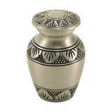
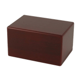
Families often assume that if a cemetery does not use headstones, the only memorial is the coordinate. In reality, the memorial can be layered. The grave location can be protected by cemetery mapping GPS, while the day-to-day remembrance happens elsewhere. For some people, that means a home display with cremation urns or cremation urns for ashes—especially if the family chose cremation or a blended plan where some remains are buried and some are kept. Funeral.com’s Cremation Urns for Ashes collection is a broad starting point for families who want a permanent, respectful vessel that fits a home or columbarium plan.
For families who prefer to share or keep only a portion, small cremation urns and keepsake urns can be a gentle solution—particularly when relatives live in different places and still want a point of connection. You can explore Small Cremation Urns for Ashes and Keepsake Cremation Urns for Ashes in a way that supports sharing without turning the decision into a sales moment. It is simply an option families use when the idea of “one single place” does not match the reality of modern life.
Others want a memorial that moves with them. This is where cremation jewelry can feel surprisingly practical, not just sentimental. A small piece can hold a symbolic amount of ashes and give someone a steady anchor when travel, relocation, or family distance makes visiting difficult. Funeral.com’s Cremation Jewelry collection and its Cremation Necklaces collection are useful for browsing styles, while the Journal guide Cremation Jewelry 101 answers the questions families usually have about sealing, filling, and how much ashes a piece typically holds.
And for people who imagine a water setting as the right place—whether because of a lifelong connection to the ocean or a wish for an eco-minded farewell—water burial can be part of the plan. Funeral.com’s guidance on water burial and burial at sea helps families understand how the words are used, what rules may apply, and how to plan a moment that feels calm and respectful.
Pet Memorials and GPS: When a “Place” Matters for Grief
Families also encounter green burial ground markers in a different context: pet memorials. Not every community has a pet cemetery with traditional markers, and many families choose cremation for pets, then create a home memorial or scatter in a meaningful place (where permitted). If you are navigating pet loss, the questions often mirror human loss: “Where can we go to feel close?” and “How do we make that place findable again?”
For pet families choosing a home memorial, pet urns and pet urns for ashes can offer a steady focal point. Funeral.com’s Pet Cremation Urns for Ashes collection includes a wide range of styles, from simple boxes to photo urns. If a figurine feels more emotionally right—something that looks like a companion rather than “a container”—the Pet Figurine Cremation Urns for Ashes collection is a natural place to explore. And if multiple households want to share, Pet Keepsake Cremation Urns for Ashes can help families split ashes thoughtfully, without making anyone feel like they are “asking for too much.”
Costs and Planning: The Questions Families Are Afraid to Ask
It is common to feel uncomfortable asking cost questions in the middle of grief, but practical clarity reduces stress. Whether you are choosing green burial, cremation, or a hybrid plan, budgeting is part of caring for the people left behind. If cost is on your mind, Funeral.com’s guide to how much does cremation cost explains typical fees and what changes the total in real life. This is especially helpful when families are comparing a cemetery burial plan against a cremation plan with a later memorial, or when they are deciding between a permanent urn placement and a simpler temporary arrangement.
What matters most is that your plan is clear enough for the next decade, not just the next week. Funeral.com’s guide to preplanning a funeral can help you document preferences in a way that reduces the chance of family confusion later—especially for choices like green burial that rely on specific cemetery policies and a clear understanding of markers.
A Gentle Final Step: Confirm the Location Before You Leave
If you are present for the burial and the cemetery uses GPS or mapping, consider making one calm request before you go: ask someone—cemetery staff, a funeral director, or a trusted family member—to help you verify the location once more and capture the information in writing. Take the photos. Save the pin. Write the route. Do not treat this as bureaucracy; treat it as continuity.
Choosing conservation cemetery headstone alternatives is often about values: simplicity, stewardship, and a desire for the land to remain beautiful long after we are gone. A coordinate does not diminish that choice. It protects it. When you pair a GPS grave marker with good documentation, you give future family members a way to arrive, stand quietly, and feel connected—without needing a monument to tell them where love belongs.


